At Pima Association of Governments, we’re all about transportation planning and how you get around, including on your bicycle.
Not only does cycling help keep cars off the roads to support congestion reduction, using two-foot pedal power is good for air quality, is an affordable form of mobility, and can improve your health. Not to mention, cycling is fun.
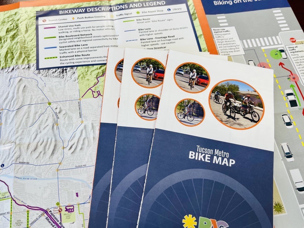
To share our enthusiasm for cycling, we developed and regularly update the Tucson Metro Bike Map to help you plan trips whenever you jump on your bike. The map displays bicycle infrastructure amenities such as shared-use paths, bike boulevards, enhanced routes, and separated bike lanes to help you find the easiest and safest way to get to your destination.
A great feature of the new map is its regionality, which makes it a comprehensive resource.
“To assemble data and update the map, we pulled together data about road features from each of the jurisdictions within the County by working with their GIS and Planning staffs,” said Mead Mier-Wellborn, Planning Manager with PAG. “We are extremely grateful to the local experts who filled data gaps and provided detailed review on draft versions of the paper map based on their knowledge on the ground.”
The Tucson Metro Bike Map compiles all of the bicycle amenities in the various jurisdictions in a single document, making it useful to residents across the metro area. For instance, the map includes Pima County’s extensive Chuck Huckelberry Loop (a non-motorized, off-road path along the river parks), the City of Tucson’s convenient bicycle boulevards, and the different bike lane features throughout the region.
“From a cartographic standpoint, the intent was to make a visually appealing map but also add another layer of information that the previous bike maps had lacked – place labels. On the new and improved bike map you will find transit centers, parks, waterways, and other points of reference labeled,” said PAG GIS Coordinator Derek Weatherly.
Another big improvement is the enhanced safety tips and diagrams that surround the map to help clarify terminology, such as Bike Boulevard (family-friendly routes that safely provide connectivity through neighborhoods). Also included are new cycling safety tips, a glossary of hand signals for cycling, theft prevention and other strategies to make you bike wise.
PAG partnered with local bike repair locations that help distribute the map to cyclists. Not only do many shops all over the metro area have it, but it’s free.
For those who prefer to access the map online, an interactive version is available to zoom in for greater detail. Find a printable version of the map, interactive link, and a list of locations where you can pick up a copy.